Nos. 14-20 Two munros and a few others…

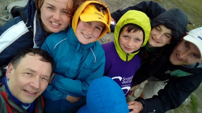
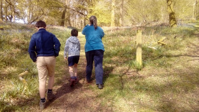
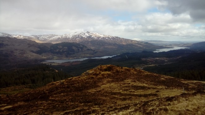
Getting back on track to achieve 50 was going to take some big walks, and this was the first of those.  With the rest of the family away at scout camp, and the weather set fair – if a bit windy – I headed off to Glenartney, bike somehow crammed into the back of the wee car, for an early start.  A chilly morning at the car park by the church, where at 8am a fisherman was getting ready for his day’s sport, and a couple were cooking up coffee and breakfast on a camping stove.  2km on the bike to the end of the road, then a bit more up a stony track, then on by foot.  Not long till a first view of the two big ones…

LG_import_22Sep2018 001

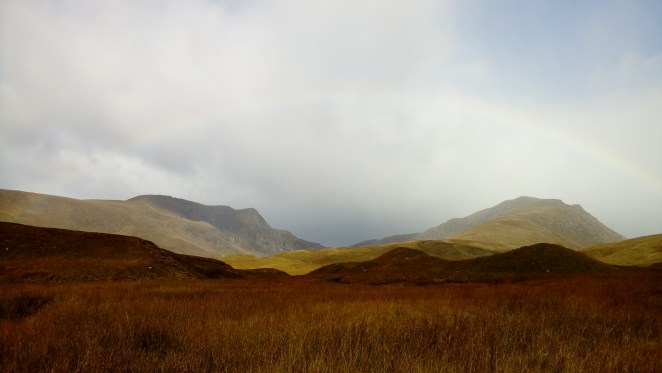
…and getting closer now (can you see the rainbow? – it was that sort of morning, short showers and lots of sun).  I was heading for the ride on the right, leading up to the top of Ben Vorlich.

LG_import_22Sep2018 003

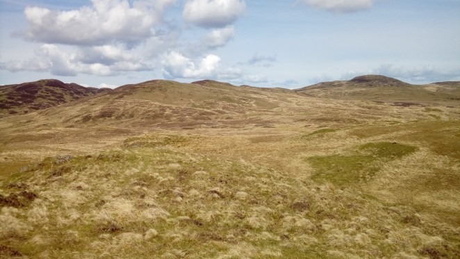
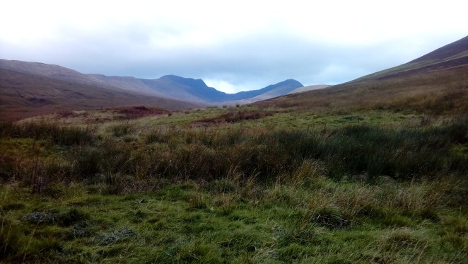
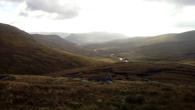
And it was a long walk in. Here’s a view back along the Gleann an Dubh Choirein from not very far up the ridge:

LG_import_22Sep2018 004

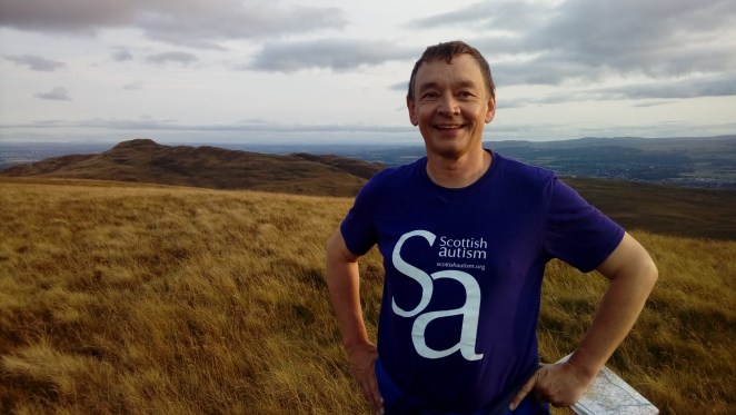
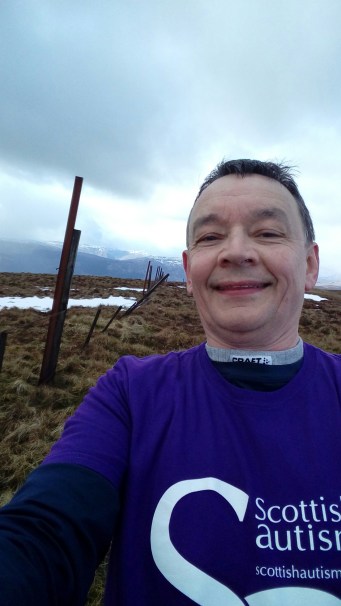
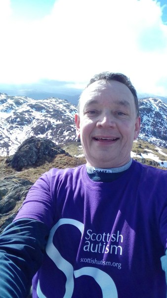
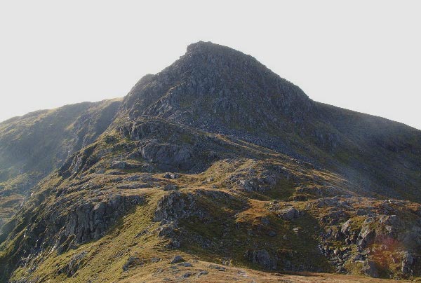
Sadly that’s the last photo action from my phone.  No summit photos today folks!  When I had finally slogged my way (3hrs+) all the way to the top, a man volunteered to take the summit photo (I’d already taken his) but did something to make the phone stop working, altogether.  It might have been something to do with windchill – it was cold up there – but it didn’t recover till I was back home.  So for the rest of this post, I’ve ‘borrowed’ other folks’ photos (just a couple..) to give you an idea.

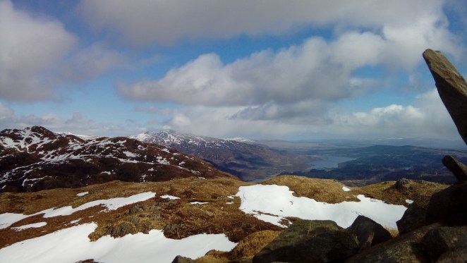
After the long solitary walk in from the south, at the top of Ben Vorlich you meet all the folk who’ve come up from Ardvorlich on Loch Earn, and it suddenly feels quite busy.  Many were going on to Stuc a’Chroin, some of us by the most direct route, a right good scramble!

Stuc a' Chroin

Most satisfying to get to the top, which was even busier, but then heading back south along the ridge, I was back on my own again (I only saw two more walkers for the whole of the rest of the day).  This is a lovely grassy gentle descent for really quite a long way, which was fabulous for already tired legs.  Some peat hags to get through, and then a short climb to the top of Meall Odhar.  Not an obvious summit, which is a contrast with little brother Tom Odhar, who very rightly deserves his own moniker on the OS map – a neat little hill, where I sat in the sun for some time contemplating whether I was capable of much more…

There were a few more hills kind of within range, but the other side of some unattractive looking bog, and I’d already been going for 7 hours or so.  (Also, I’ve just discovered, the other side of the highland fault to the first part of my walk!)  But after a wee rest and some more flapjack, I decided to give it a go.  For the next hour (at least) I was heading for the summit of Uamh Bheag, which was kind of distant but kind of looming.  After a while I was put in mind of the final ascent of Mount Doom, as I crossed a quintessentially Scottish version of the plains of Mordor – tussocks, sucking bog, bracken, heather, hidden holes and burns.  My legs were so tired on the last bit of the climb that it felt like I was carrying another, though fortunately there was no Gollum waiting for me at the top.  Or was there?  I’m not sure who the odd carving at the top is supposed to represent, but looks a bit grinny for Gollum…

Top_of_Uamh_Bheag  Am_Beannan

A quick jaunt over to the summit of Am Beannan (above is the view from down below, roughly where I’d left my bike.  And it wasn’t at all snowy when I was looking!), where I startled a herd of 40-50 deer.  Finally over the indiscernible top of Meall Clachach (I don’t think anyone’s ever taken a photo), straight down for a bit of a wade in the ‘Water of Ruchill’, a last excrutiating 80m ascent to the bike, then weeeeeee down the boneshakingly stony hill, back onto the road and back to a lonely car.  Some well deserved fish’n’chips in Comrie on the way home.


No. 13 Craig Leith

Another sunny Saturday, off to the Ochils with the dear boys, where we were to attempt to climb the escarpment up from Alva and then do a horseshoe walk taking in a couple of hills.  It was steep up, with the customary great views, interesting features, and plenty of scrambling opportunities…

LG_import_25Aug2018 100 LG_import_25Aug2018 103 LG_import_25Aug2018 104

…a picnic spot with a neat summit cairn, and contours on the map, but alas no name…

LG_import_25Aug2018 107

…but the climb had taken its toll, so we settled for the more substantial cairn on the summit above the impressive crags of Craig Leith as our top.  Alexander’s turn to model the summit T-shirt!

LG_import_25Aug2018 109

LG_import_25Aug2018 110

No. 12 Loss Hill

We had a lovely week in Donegal with our friends Steve and Heather and their kids – beaches, surfing, cycling, horseriding – but no hills!  After we’d returned home, they bravely headed off on a camping holiday at various points along the west coast of Scotland – the weather, by now, having returned to standard Scottish summer ‘changeable’!  They called in to see us on their way back south, and after a long drive, Steve was keen for a walk, preferably going up something.  Sensing a ‘two birds with one stone’ opportunity, I quickly located a hill with a name we could go up, fairly close to home (time was limited), and off we went.  Loss Hill is a fairly unremarkable rounded lump at the west end of the Ochils, we approached it round the edge of a ploughed field, over a fence and up.  But the views were great – past Dumyat over the Forth valley, west and north to Ben Lomond, the Trossachs, the Perthshire hills.  And the company was splendid, thank you Steve!

LG_import_25Aug2018 097

LG_import_25Aug2018 098

No. 11 Arthur’s Seat

A Saturday morning at the height of the Edinburgh Festival, where better to head for a solitary stroll than Arthur’s Seat?  Strangely, in all my years of coming to Edinburgh, my first time up.  Needless to say it was hoaching, “so meny peple langages and tonges” (I never expected to refer back to my medieval studies in this blog…), a diversity matched by a remarkable range of footwear and clothing, some appropriate for the climb, some rather less so!  It was a great walk to do with the boys, we had a lot of fun looking at Edinburgh from above, spotting things we knew and seeing how they fit together, and thinking about the evolution of cities from higgledy-piggledy old centres to formal town planning, suburban drift, and squeezing things in the spaces remaining.

LG_import_25Aug2018 083

LG_import_25Aug2018 084  LG_import_25Aug2018 081

No. 10 Carn Breugach, Kerrera

And so the glorious Scottish summer continued… A first family outing to the west coast, and we really fancied an island adventure.  So we drove over to Oban and found the little ferry – strictly 12 people at a time, no more – that takes you over to the island of Kerrera.  We had a lovely day – picnic on the beach, overlooking Mull, Lismore and much boat traffic; the walk round the island, taking in the very welcome (and wonderful) tea shop; and as a grand finale, Sam and I toiled our way up to the highest point of the island (a monster 189m), called Carn Breugach.  Not all that frequently visited, we thought – finding a way down in the direction of the ferry proved quite a challenge!  However, we all made it back off the island in time for fish and chips in Oban…

LG_download_14July2018 069  LG_download_14July2018 072

LG_download_14July2018 074

LG_download_14July2018 076

LG_download_14July2018 067

No. 9 Conic Hill

On this weekend Sam and the other PLs and APLs from his scout troop had enterprisingly organised themselves to walk a chunk of the West Highland Way alongside Loch Lomond, with some midgy camping overnight thrown in.  On my way to meet them at Rowardennan at the end of their expedition, I stopped off for a quick dash up Conic Hill.  It was another stunning day in our extended spell of lovely weather – the scouts struggled with the sun beating down on them – and it was hot work.  A busy Sunday on the hill, I was snapped by some obliging Americans, to spare us all from another selfie…

LG_download_14July2018 014  LG_download_14July2018 017

LG_download_14July2018 015

LG_download_14July2018 016


No. 8 Ben Ledi

A week later and a different climate… Ben Ledi is another much-walked hill, in the heart of the Loch Lomond & Trossachs national park.  Special visitors this time, Nigel, Maya and Yolands, up from Durham, and sister-in-law Fiona, on a break from PhD studies.  Not a day for lingering at the summit, the wind was strong and cold… Thanks to Sam for taking on summit t-shirt duties!

LG_import_21May2018 029

LG_import_21May2018 031

No. 7 Carstramon Hill

After two kinds of break – an Easter holiday skiing trip with friends in Sweden, and slow-mending broken ribs which may have been related to the first break – finally the chance to take advantage of some beautiful May weather.  Carstramon is a favourite place, fabulous woods on a hill in the Fleet valley in Galloway.  Thanks to a walk there later this year with forester friend Andrew, I now know that it’s woodland type NVC W11, though with lots of introduced beech – thanks Andrew!  Bluebell-carpeted in spring, and with excellent year-round tree-climbing opportunities, we are there as often as can be, almost always just to explore the woods.  But at the top of the woods you can walk out on to a tussocky hillside and up to the summit, for some great views.

LG_import_15May2018 061

LG_import_15May2018 067    LG_import_15May2018 065

LG_import_15May2018 069

LG_import_15May2018 072

LG_import_15May2018 078


No. 6 Dumyat

Which is probably the most walked hill in this part of the world, up above Stirling, in a place of its own at the end of, but somehow not quite connected to, the Ochils escarpment.  In the spirit of variety, Sam and I opted to do this one as a fell run, on a glorious spring morning.  Probably not so much running on the way up, but down was fun!  Me and my mountain goat companion at the top – well done Sam!

LG_25Mar2018 002LG_25Mar2018 001

Nos. 4-5 Beinn an Fhogharaidh / Ben Venue

This walk – a circuit up from the car park at the west end of Loch Achray – is the first which really prompted me to ask, when is a hill not a hill?  You see, the OS 1:50000 and 1:25000 maps are unanimous that when you get up on to the ridge on the south side of a sort of horseshoe that goes round to Ben Venue the other side of the glen, you ascend something called Beinn an Fhogharaidh.  On the 1:25000 map in a font size the same as Ben Venue itself.  The view’s very nice…

LG_import_24Mar2018 022

…but feeling that you were on the top of something and finding its summit, well, eventually I chose a tussock that was slightly higher than all the other tussocks for the summit selfie.  You can see the doubt in my eyes…

LG_import_24Mar2018 028

Then a bit further along the ridge you come across a veritable summit, named Stob an Lochain on the 1:25000 map in a tiny font, but unacknowledged on the 1:50000 map apart from the contours, which rather give the game away.  Again, terrific views (looking east over Lochs Achray and Venachar).  But was it a hill to count towards the 50?

LG_import_24Mar2018 034

No time to linger, as there were big black clouds rolling in from the west, quickly down to the col and up Ben Venue.  Still plenty of snow on the ground, and the first part of the climb from the col involved kicking steps into a steep drift.  Ben Venue has a couple of summits, the maps say the north-westerly one is a couple of metres higher, so that’s where I took the summit selfie…

LG_import_24Mar2018 036

…and the view over to the other top, which has the more official-looking trig point (and a small crowd on top).

LG_import_24Mar2018 038

When I got there, it was deserted – looking back to where I’d just come from, it seems we’d all crossed paths…

LG_import_24Mar2018 057